 Most people do not think about the fact that we have to know so much about our world and a lot of it comes through mapping it out. There are people devoted to mapping our oceans, our lands, and even what may be within the Earth’s core. Each part of mapping the Earth is important. We gain massive amounts of information from each new area mapped out.
What We Discover by Mapping Oceans
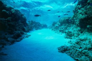
It is pretty easy to see why we map landmasses. How else would we get where we are going if we didn’t have a map that could guide us? This does not help us when we are in the ocean does it? The truth is, we can learn massive amounts of information by looking deep into the ocean.
The biggest benefit of mapping the ocean is that we can study areas of shallow water, which can be very useful in telling where it is safe for ships to travel. It ensures that they do not hit land. Beyond the safety and defense of the US, we also need to understand the waterways and how it may impact the weather.
For instance, a tsunami is caused by an earthquake that takes place in the ocean. Plates shift and waves form. It can wipe out entire areas. The best way to try and know when or if it may happen is to know where fault lines may be located.
The problem is, it is difficult to map the ocean and it can be time-consuming. Therefore, we still do not know everything that we can learn based on the bottom of our ocean floors.
What Do We Learn From Mapping Land?
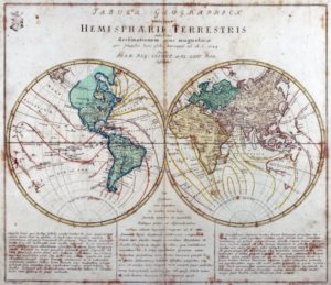 Land mapping is a little easier to see and understand. We map land so that we can see how large it is, where borders and boundaries are, how to travel from here to there, and more. Mapping makes it easy for us to see where mountains are located as well as other features of our Earth.
For this reason, the idea of mapping has been something we have done since ancient Greek and Roman times. For as far back as we have been researching our history, there have been those who wanted to map things out to see what was there. Now, we have more high-tech mapping abilities, but it does not change that some of the information on our maps today began with them.
What you may not consider is that you can also learn more. We can see settlement patterns. With thermal mapping, we can see where there is a higher risk of pollution in the atmosphere. There are several different types of maps and we can learn a little more about our world with each one.
Our Earth’s Core? Mapping It Matters, Too!
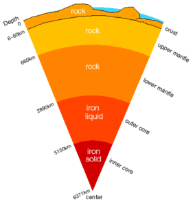 We know that Earth is made up of four layers. In the core, we have a solid iron ball. It measures about 1,500 miles in diameter. It is extremely hot and estimates are that it is approximately 9,000 and 13,000 degrees Fahrenheit. It is surrounded by a liquid iron shell that is around 1,400 miles thick. It is what keeps us on our magnetic center.
The next layer is the mantle. It is around 1,800 miles thick and divided into the upper and lower mantle. In the mantle, you will discover molten rock flowing in a slow-moving river. You may know it better as molten lava, but it is actually rock.
Currents within this mantle are broken into blocks or plates. They move around and occasionally collide to build mountains and other things.
The crust of one of those plates is what forms the continents that we live in. It is the river beds and ocean floors. This is the easy stuff to learn about. The inner stuff can only be done through studying movements on the crust.